
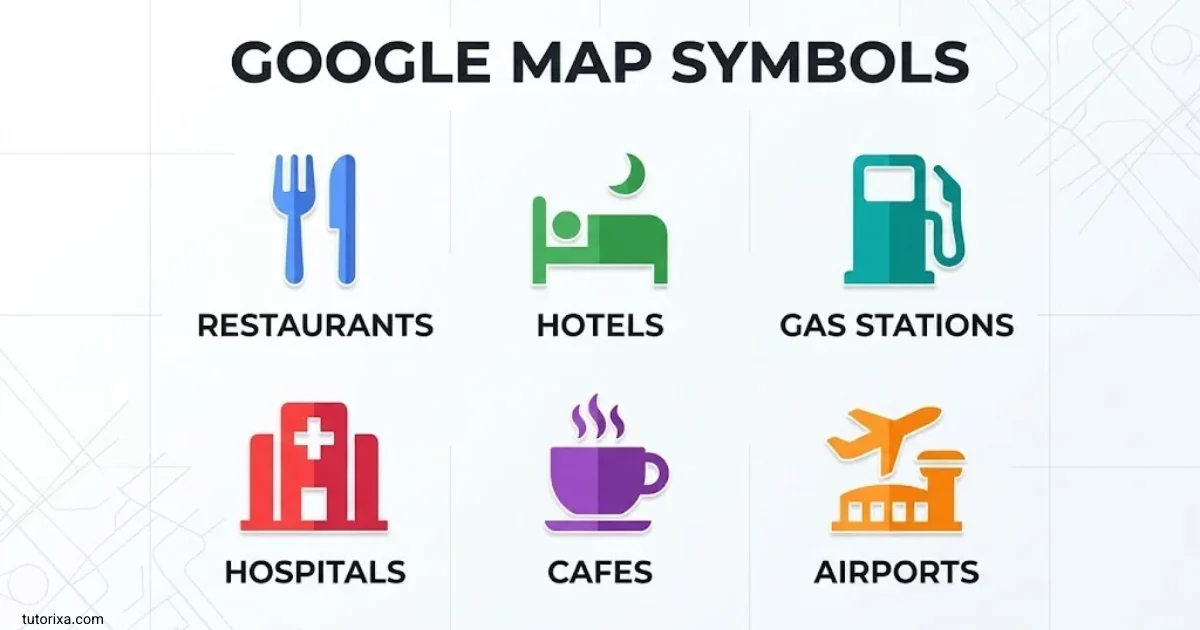
Google Maps uses symbols, colors, and small icons to help you understand roads, find places, check traffic, and navigate to your destination. Each symbol provides a different type of information, from restaurant locations and parking areas to road closures and driving directions. Learning these symbols makes the map easier to read, especially when you are exploring an unfamiliar area.
If you are looking for Google Map symbols and meanings, this guide explains the most common icons, map markers, traffic colors, and pointer symbols. You will also learn how to read the map legend and understand the difference between symbols displayed directly in Google Maps and text characters you can copy and paste.
The exact icons you see can vary depending on your device, map layer, zoom level, location, and app version. Use the examples below as a practical guide to understanding what appears on your screen.
Google Map Symbols And Meanings
Google Maps displays different symbols to represent places, transportation, road conditions, and navigation features. Some icons identify businesses and public facilities, while others show your current location or help you follow a route.
Here are common Google Maps symbols and what they generally mean.
| Symbol or icon | Meaning |
| 📍 | Location pin or marked place |
| 🔵 | Blue location dot, commonly showing your current position |
| ⭐ | Star used to mark saved or favorite places in supported contexts |
| 🍴 | Restaurant or dining-related symbol |
| ☕ | Cafe or coffee-related symbol |
| 🅿 | Parking-related symbol |
| 🏥 | Hospital or medical facility |
| 🏨 | Hotel or lodging |
| ⛽ | Gas station or fuel stop |
| 🚌 | Bus or bus transportation |
| 🚆 | Train or rail transportation |
| ✈️ | Airport or air travel |
| 🚲 | Bicycle or cycling-related information |
| 🚶 | Walking or pedestrian travel |
| 🚗 | Car or driving-related information |
Important: These emoji are visual examples, not a complete reproduction of Google’s official map icons. Google Maps often uses its own pictograms, and the exact appearance can differ across platforms.
Common Google Maps Location Symbols
- Red place pin: Often marks a selected destination or a place of interest.
- Blue dot: Usually represents your current location when location services are available.
- Blue route line: Shows a selected navigation route in many driving and walking views.
- Gray route line: Can represent an alternative route or another road, depending on the map view.
- Compass: Helps indicate the map’s orientation, especially when the map is rotated.
- Layers icon: Opens map display options, such as satellite imagery and traffic, where available.
- Search icon: Lets you search for addresses, businesses, and other places.
- Directions icon: Opens route planning for getting from one location to another.
A symbol’s meaning depends on where it appears. For example, a pin may identify a business, a searched address, or a location you have manually selected.
How To Read Google Map Symbols
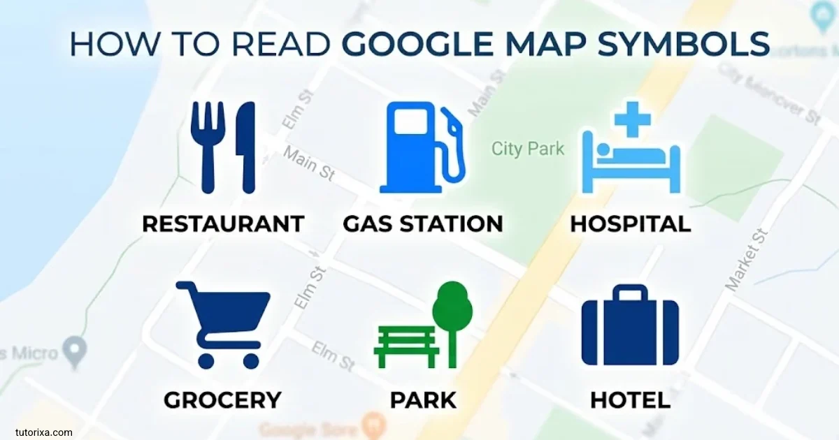
Reading Google Maps becomes easier when you understand the difference between place icons, road markings, route colors, and navigation controls. Start by identifying the part of the map you are looking at, then check the symbol’s position and surrounding information.
1. Identify The Location Marker
Look for the pin or dot that indicates a place or your current position. Tap a marker to see available information, such as the place name, address, opening hours, photos, or reviews.
2. Follow The Route Line
When you request directions, Google Maps displays a highlighted route. Follow that line to understand which roads or paths to take. If several routes appear, compare the estimated travel time, distance, and any warnings shown.
3. Check Road And Traffic Colors
Traffic colors can help you identify congestion on roads when the traffic layer or relevant navigation information is available. However, not every colored line represents traffic. Some colors identify selected routes, transit lines, or other map features.
4. Read Place Icons And Labels
Icons near roads and neighborhoods can identify businesses, attractions, transportation stations, and public services. Tap the icon or its label when you need more details.
5. Use The Map Controls
The main controls help you change your view and move around the map.
- Search: Find an address or place.
- Directions: Choose a starting point and destination.
- Layers: Switch between available map types and information overlays.
- Compass: Restore or check the map’s orientation.
- Location button: Return to your current position when location access is enabled.
If a symbol is unfamiliar, tap it when possible. The information card or map legend may explain its purpose more clearly than the icon alone.
Google Map Symbols Legend
A Google Maps legend is a guide to the colors, lines, and symbols used to display geographic information. Google Maps does not always provide one universal legend showing every icon at once. Instead, explanations can depend on the selected map layer and the feature you are viewing.
Use this reference to understand common map elements.
| Map element | What it generally indicates |
| Blue dot | Your approximate current location |
| Red location pin | A selected place or destination |
| Highlighted route | The route chosen for navigation |
| Green traffic line | Traffic moving relatively freely |
| Orange traffic line | Moderate or slowing traffic |
| Red traffic line | Heavy traffic or delays |
| Dark red traffic line | Very slow traffic in views that use this distinction |
| Gray road | A road without a highlighted traffic or route overlay |
| Dotted or dashed line | May indicate a walking path, boundary, or other feature, depending on context |
| Transit icon | A public transportation stop or station |
| Place-of-interest icon | A business, attraction, or facility |
| Compass indicator | Map orientation |
Traffic colors and line styles are contextual rather than universal. For example, a gray road may simply be a road without a selected route, while a dashed line may have different meanings in different map layers.
Where To Find Map Information
To explore the legend-like information available in Google Maps:
- Open Google Maps.
- Tap the Layers button, usually shown as stacked shapes.
- Select an available layer, such as Traffic or Satellite.
- Review the displayed information and any explanatory labels.
- Zoom in or out to reveal more roads, place names, and details.
The available layers vary by area and device. Some features may not appear at every zoom level.
Google Map Symbols List
This Google Maps symbol list groups common icons by their purpose so you can identify them quickly. The characters in the table are representative symbols rather than exact copies of every icon used by the app.
Location And Navigation Symbols
| Symbol | Name | Meaning |
| 📍 | Location pin | Marks a place or selected destination |
| 🔵 | Blue location dot | Shows your current position when available |
| 🧭 | Compass | Represents direction or orientation |
| ➡️ | Direction arrow | Represents a direction or movement |
| 🏁 | Finish flag | Commonly represents an endpoint in illustrations |
| 🔍 | Search | Represents finding a place or item |
Places And Services Symbols
| Symbol | Name | Meaning |
| 🍽️ | Dining | Restaurant or food-related place |
| ☕ | Cafe | Coffee shop or cafe |
| 🛍️ | Shopping | Retail or shopping-related location |
| 🏨 | Hotel | Accommodation |
| 🏥 | Hospital | Medical care |
| 💊 | Pharmacy | Medication or pharmacy-related service |
| ⛽ | Fuel station | Fuel or gas station |
| 🅿️ | Parking | Parking-related facility |
| 🏦 | Bank | Banking service |
| 🏧 | ATM | Cash withdrawal facility |
Transportation Symbols
| Symbol | Name | Meaning |
| 🚌 | Bus | Bus transport or bus stop |
| 🚆 | Train | Rail transport |
| 🚇 | Metro | Subway or underground transport |
| 🚉 | Railway station | Train station |
| ✈️ | Airplane | Airport or air travel |
| 🚲 | Bicycle | Cycling or bicycle-related facility |
| 🚶 | Pedestrian | Walking or walking directions |
| 🚗 | Car | Driving or car-related travel |
| ⛴️ | Ferry | Ferry transportation |
How To Use This List
Use these symbols as a quick visual reference when learning to read maps, making travel notes, or explaining directions to someone. For accurate identification, compare the symbol with the icon displayed in Google Maps rather than assuming that every emoji corresponds to an official Google Maps marker.
Google Map Symbols Traffic
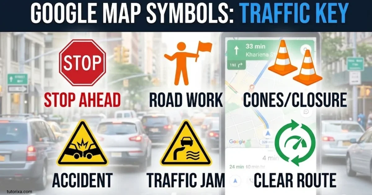
Google Maps traffic symbols help drivers understand road congestion and choose a suitable route. When traffic information is available and the Traffic layer is enabled, colored lines appear along certain roads.
━
Green traffic line
Traffic is generally moving freely or with relatively little delay.
━
Orange traffic line
Traffic is slower than usual, suggesting moderate congestion or delays.
━
Red traffic line
Traffic is heavy, and vehicles may be moving slowly.
━
Dark red or maroon traffic line
Some map views use a darker red shade for especially slow traffic. The precise color scale can vary.
Other Traffic And Road Symbols
- Crash or collision icon: May identify a reported road incident.
- Roadwork icon: Can indicate construction or maintenance.
- Road closure notice: Warns that a road or section may be closed.
- Hazard warning: May identify a reported obstruction or other road issue.
- Alternative route: A separate route option that may take a different road or have a different estimated travel time.
The availability and appearance of incident icons depend on the area, reporting data, and app version.
How To Turn On Traffic Information
- Open Google Maps on your phone or computer.
- Select the Layers control.
- Choose Traffic, if available.
- Look at the colored lines along roads.
- Select your destination and compare the available routes before travelling.
Traffic information can change quickly. Check the estimated arrival time and route warnings again before you leave, and never interact with your phone while driving.
Google Map Symbols Copy And Paste
If you want Google Maps-related symbols for notes, social media posts, travel plans, or messages, you can copy the characters below and paste them wherever they are supported.
These are standard text characters and emoji, not a collection of official Google Maps icons. Their appearance may change depending on your device, operating system, or app.
Location And Map Symbols To Copy
📍Location pinTap to copy
🗺️World mapTap to copy
🧭CompassTap to copy
🌍GlobeTap to copy
🚩FlagTap to copy
⭐StarTap to copy
⌖Position markerTap to copy
◎Target markerTap to copy
⊕Circled plusTap to copy
➤Arrow pointerTap to copy
➜Right arrowTap to copy
↑Up arrowTap to copy
↓Down arrowTap to copy
←Left arrowTap to copy
→Right arrowTap to copy
↗Northeast arrowTap to copy
Traffic And Transportation Symbols
| Symbol | Name |
| 🚗 | Car |
| 🚕 | Taxi |
| 🚌 | Bus |
| 🚆 | Train |
| 🚇 | Metro |
| 🚲 | Bicycle |
| 🚶 | Walking |
| ✈️ | Airplane |
| ⛴️ | Ferry |
| ⛽ | Fuel station |
| 🅿️ | Parking |
| 🚦 | Traffic light |
| 🚧 | Roadwork |
| ⚠️ | Warning |
| ⛔ | No entry |
| 🚫 | Prohibited |
Simple Map And Direction Symbols
Copy these symbols for travel notes, location descriptions, and informal maps.
Arrows
↑ ↓ ← → ↗ ↖ ↘ ↙
Copy
Navigation
➤ ➜ ➝ ➞ ➟ ➠ ➥
Copy
Markers
📍 ⌖ ◎ ⊙ ◉ ● ○
Copy
Road and travel
🚗 🚦 🚧 🛣️ 🗺️
Copy
How To Copy And Paste Map Symbols
- Choose a symbol or group of symbols.
- Click or tap it to copy, if the interactive symbol grid is available.
- Open your message, document, social media post, or notes app.
- Paste the symbol using Ctrl + V on Windows or Command + V on Mac.
On mobile devices, tap and hold a text character if you need to select and copy it manually.
Remember that copying an emoji does not create a live Google Maps link or an interactive location marker. To share an actual place, use Google Maps’ built-in Share option.
Pointer Google Map Symbols
Pointer symbols help represent a location, direction, or point of interest. In Google Maps, the most familiar location indicator is the blue dot, while pins commonly identify searched places and selected destinations.
Here are useful pointer-related symbols and their meanings.
| Symbol | Name | Typical use |
| 📍 | Location pin | Marking a place or destination |
| 📌 | Pushpin | Marking an important point in notes |
| 🔵 | Blue circle | Illustrating a current-location marker |
| ⌖ | Position symbol | Representing a point or position in text |
| ◎ | Double-circle target | Highlighting a specific point |
| ➤ | Arrow pointer | Showing a direction |
| ➜ | Right arrow | Indicating movement or a route |
| 🧭 | Compass | Representing navigation and orientation |
What Does The Blue Pointer Mean In Google Maps?
The blue dot generally shows your current location when Google Maps has access to location information. A blue cone or directional beam may appear around it to indicate the direction your device is facing, although its appearance depends on the app and available sensor information.
If the blue dot is inaccurate, check that your device’s location services are enabled. Moving to an open area and calibrating the compass, when prompted, may also improve location and direction accuracy.
What Does A Red Pin Mean?
A red pin often marks a selected location, searched destination, or place of interest. Tap the pin to open its information card. Depending on the place, you may see its name, address, directions, reviews, or other details.
Do not assume that every pin has the same meaning. Its function depends on how it was placed and which map feature is active.
Vector Google Map Symbols
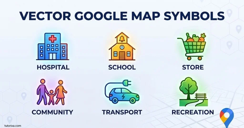
Vector map symbols are graphical icons and shapes used to represent geographic features, roads, places, and navigation information. In digital mapping, vector graphics describe shapes through mathematical paths rather than storing every detail as a fixed grid of pixels.
Google Maps uses sophisticated digital map rendering, but the icons you see are not all available as individual, official Unicode characters. Many are part of Google’s own interface and map design.
Common Types Of Vector Map Symbols
Location pins
Pin-shaped graphics identify selected locations, businesses, destinations, and points of interest.
Road and route graphics
Lines and directional indicators show roads, route choices, and travel paths.
Small pictograms represent transit stations, bus stops, airports, and other transport-related places.
Compass and direction graphics
These symbols represent orientation, navigation, or directional information.
Vector Symbols Vs. Unicode Symbols
The distinction matters if you want to reuse a Google Maps icon outside the app.
| Feature | Vector map icon | Unicode text symbol |
| Main purpose | Displaying map information | Displaying a character in text |
| Appearance | Depends on the map’s design and rendering | Depends on the character and font |
| Copy and paste | May require an image or graphics file | Usually copied as text |
| Typical example | A custom Google Maps location marker | 📍 or → |
| Interactivity | Can be part of a live map interface | Usually just a text character |
If you need an official Google Maps icon for a website or application, use the appropriate Google Maps Platform documentation and permitted assets rather than assuming an emoji is equivalent. If you simply need a location symbol for a caption or message, Unicode characters are usually more convenient.
Frequently Asked Questions
What Do The Different Symbols On Google Maps Mean?
Google Maps symbols identify locations, businesses, roads, transportation services, and navigation features. Their meanings depend on the icon, the selected map layer, and the context in which they appear.
What Do The Green, Orange, And Red Lines Mean On Google Maps?
When the traffic layer is active, green generally indicates freely moving traffic, orange indicates slower traffic, and red indicates heavy congestion. Exact conditions and color distinctions can vary.
What Is The Blue Dot On Google Maps?
The blue dot usually represents your current location. A surrounding directional beam may indicate which way your device is facing.
Can I Copy And Paste Google Maps Symbols?
You can copy and paste text characters and emoji, such as 📍, 🗺️, 🧭, and →. However, these are not necessarily the same graphics Google Maps uses in its interface.
How Can I See All Symbols In Google Maps?
There is no single universal screen that lists every Google Maps symbol. Use the Layers control to explore available map features, and tap individual place markers or interface icons to learn more about them.
Conclusion
Google Map symbols make it easier to understand locations, routes, traffic conditions, and nearby services. Once you recognize common markers, road colors, transportation icons, and navigation controls, you can interpret the map more confidently and find useful information faster.
If you need symbols for personal notes, travel guides, websites, or social media, the copy-and-paste collections in this article provide convenient options. Just remember that text symbols and emoji are visual alternatives, not exact replacements for Google’s own map icons.
For the most accurate information, check the symbol in its original Google Maps context. Traffic conditions, map layers, and available icons can change, so use the live map and its displayed details when planning a journey.

I’m Freddie Beaumont, a British author with a passion for discovering what symbols communicate without words. I write about their history, meanings, and everyday uses in an accessible way. I believe symbols tell fascinating stories about people, cultures, and ideas, and my work helps readers recognise and understand those stories more clearly.
Books:
- Symbols and Their Hidden Meanings
- Understanding Signs and Symbols
 Rowan Whitaker
 Ellis Montgomery